Oslob
Oslob | |
|---|---|
 | |
 Kinamumugtakan kan Oslob | |
 | |
| Tagboan: 9°33′0″N 123°24′0″E Tagboan: 9°33′0″N 123°24′0″E | |
| Nasyon | Filipinas |
| Pigtugdas | 1848 |
| Barangay | 21 |
| Pamamahala | |
| • Electorado | 20,972 votantes (9 Mayo 2022) |
| Hiwas | |
| • Kabuuhan | 134.75 km2 (52.03 sq mi) |
| Elebasyon | 142 m (466 ft) |
| Populasyon (Mayo 1, 2020)[1] | |
| • kabuuhan | 29,264 |
| • Densidad | 220/km2 (560/sq mi) |
| • Saro | 6,995 |
| Economia | |
| • Klase | ikaapat na klaseng banwaan |
| • Ingresos | ₱179,355,926.26 (2020) |
| • Activos | ₱975,710,814.48 (2020) |
| • Pasivos | ₱77,901,917.22 (2020) |
| • Gastos | ₱126,233,778.90 (2020) |
| Kodigo nin postal | 6025 |
| PSGC | 072235000 |
| Kodigo telefonico | 32 |
| Tataramon | Tataramon na Cebuano tataramon na Tagalog |
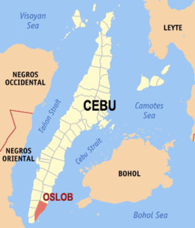
An Oslob sarong ikaapat na klaseng banwaan sa provincia kan Cebu, Filipinas. An designadong zip code kaini iyo 6025.
Sosog sa sensus kan 1 Mayo 2020, igwa ining 29,264 katawong nag-eerok digdi sa 6,995 kaharongan.
Igwa ining sukol na 134.75 kilometro kwadrado.
Mga Barangay

Nababanga an Oslob sa 9 barangay.
|
|
Demograpiko
| Taon | Tawo | ±% p.a. |
|---|---|---|
| 1903 | 9,819 | — |
| 1918 | 12,351 | +1.54% |
| 1939 | 13,473 | +0.41% |
| 1948 | 13,614 | +0.12% |
| 1960 | 14,497 | +0.52% |
| 1970 | 16,290 | +1.17% |
| 1975 | 18,799 | +2.91% |
| 1980 | 19,053 | +0.27% |
| 1990 | 19,782 | +0.38% |
| 1995 | 21,686 | +1.74% |
| 2000 | 22,472 | +0.77% |
| 2007 | 22,732 | +0.16% |
| 2010 | 26,116 | +5.18% |
| 2015 | 27,893 | +1.26% |
| 2020 | 29,264 | +0.95% |
| Toltolan: Philippine Statistics Authority[2][3][4][5] | ||
Toltolan
- ↑ "2020 Census of Population and Housing (2020 CPH) Population Counts Declared Official by the President". Hulyo 7, 2021. Check date values in:
|date=(help) - ↑ Sensus kan Populasyon (2015). "Rehiyon VII (Sentral Bisaya)". Kabuuhang Populasyon kan lambang Provincia, Syudad, Banwaan asin Barangay. PSA. Retrieved 20 Jun 2016.
- ↑ Census of Population and Housing (2010). "Rehiyon VII (Sentral Bisaya)". Kabuuhan populasyon sa lambang Provincia, Syudad, Banwaan asin Barangay. NSO. Retrieved 29 Jun 2016.
- ↑ Mga Sensus kan Populasyon (1903–2007). "Rehiyon VII (Sentral Bisaya)". Table 1. Population Enumerated in Various Censuses by Province/Highly Urbanized City: 1903 to 2007. NSO.
- ↑ "Province of Cebu". Municipality Population Data. LWUA Research Division. Retrieved 17 December 2016.