Clerques
Clerques
Klarke | |
|---|---|
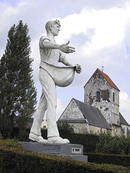 The Sower and Saint-Barthélémy's church | |
 Coat of arms | |
 Clerques  Clerques | |
| Coordinates: 50°47′37″N 1°59′43″E / 50.7936°N 1.9953°E | |
| Country | France |
| Region | Hauts-de-France |
| Department | Pas-de-Calais |
| Arrondissement | Saint-Omer |
| Canton | Lumbres |
| Intercommunality | Pays de Lumbres |
| Government | |
| • Mayor (2020–2026) | Aurélien Dommanget[1] |
Area 1 | 6.39 km2 (2.47 sq mi) |
| Population (2022)[2] | 314 |
| • Density | 49/km2 (130/sq mi) |
| Time zone | UTC+01:00 (CET) |
| • Summer (DST) | UTC+02:00 (CEST) |
| INSEE/Postal code | 62228 /62890 |
| Elevation | 37–173 m (121–568 ft) (avg. 47 m or 154 ft) |
| 1 French Land Register data, which excludes lakes, ponds, glaciers > 1 km2 (0.386 sq mi or 247 acres) and river estuaries. | |
Clerques (French pronunciation: [klɛʁk]; West Flemish: Klarke) is a commune in the Pas-de-Calais department in the Hauts-de-France region of France[3] 10 miles (16 km) northwest of Saint-Omer, in the valley of the river Hem at the foot of the Boulonnais, which is a wooded ridge there. Two hamlets, Audenfort to the west and Le Hamel to the east, make up the remainder of the commune.
Population
| Year | Pop. | ±% p.a. |
|---|---|---|
| 1968 | 186 | — |
| 1975 | 180 | −0.47% |
| 1982 | 209 | +2.16% |
| 1990 | 215 | +0.35% |
| 1999 | 213 | −0.10% |
| 2007 | 249 | +1.97% |
| 2012 | 285 | +2.74% |
| 2017 | 327 | +2.79% |
| Source: INSEE[4] | ||
History
On 13 August 2006 the stone bridge in the village centre, built in 1862, was destroyed after exceptional rainfall upstream at Licques.[5]
Transport
The Chemin de fer de Boulogne à Bonningues (CF de BB) opened a station at Audenfort, near Clerques, on 22 April 1900.[6] Passenger services were withdrawn on 31 December 1935.[7] They were reinstated in November 1942.[8] The CF de BB closed in 1948.[9]
See also
References
- ^ "Répertoire national des élus: les maires" (in French). data.gouv.fr, Plateforme ouverte des données publiques françaises. 13 September 2022.
- ^ "Populations de référence 2022" (in French). The National Institute of Statistics and Economic Studies. 19 December 2024.
- ^ INSEE commune file
- ^ Population en historique depuis 1968, INSEE
- ^ Conseil Général du Pas de Calais - CG62 Archived 2006-11-27 at the Wayback Machine
- ^ Farebrother & Farebrother 2008, p. 139.
- ^ Farebrother & Farebrother 2008, p. 239.
- ^ Farebrother & Farebrother 2008, p. 248.
- ^ Farebrother & Farebrother 2008, p. 276.
Sources
- Farebrother, Martin J B; Farebrother, Joan S (2008). Tortillards of Artois. Usk: The Oakwood Press. ISBN 978-0-85361-554-5.
External links
- Statistical data, INSEE
| National | |
|---|---|
| Geographic | |