Hertsmere
| Niet-metropolitaans district in Engeland | |||
|---|---|---|---|
| |||
| Situering | |||
| Land | Engeland | ||
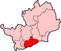
| County | Hertfordshire | ||
| Regio | East of England | ||
| Coördinaten | 51°39'36"NB, 0°16'12"WL | ||
| Algemeen | |||
| Oppervlakte | 101,1280[1] km² | ||
| Inwoners (2018[2]) |
104.205 (1030 inw./km²) | ||
| ONS-code | E07000098 | ||
| Website | www | ||
| Detailkaart | |||

| |||
| |||
Hertsmere is een Engels district in het shire-graafschap (non-metropolitan county OF county) Hertfordshire en telt 104.000 inwoners. De oppervlakte bedraagt 101 km².
Van de bevolking is 16,3% ouder dan 65 jaar. De werkloosheid bedraagt 2,3% van de beroepsbevolking (cijfers volkstelling 2001).
Plaatsen in district Hertsmere
Civil parishes in district Hertsmere
Aldenham, Elstree and Borehamwood, Ridge, Shenley, South Mimms.