Ocampo
Ocampo | |
|---|---|
 | |
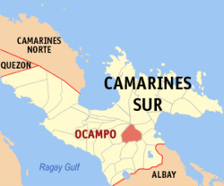 Mapa ning Camarines Sur ampong Ocampo ilage | |
 | |
| Puuk: 13°33'33.84"N, 123°22'33.96"E | |
| Bansa | Filipinas |
| Labuad | Labuad Bicol (Rehiyong V) |
| Lalawigan | Camarines Sur |
| Tuknangan | Balen |
| Mitatag | 1949 |
| Barangay | 25 |
| Sukad | |
| • Kabilugan | 118.33 km2 (45.69 sq mi) |
| Elebasyun | 109 m (358 ft) |
| Populasyun (Sensu ning 1 Mayu 2020) | |
| • Kabilugan | 51,073 |
| • Densidad | 430/km2 (1,100/sq mi) |
| • Pamimalemale | 10,967 |
| Economia | |
| • Uryan | pangatlu yang klasing balen |
| • Panakitan | ₱155,552,144.4172,181,867.9073,594,217.7484,244,674.689,966,162.12103,406,478.99119,038,056.08125,558,954.92164,558,521.16228,771,361.43 (2020) |
| • Activos | ₱335,434,971.9988,722,363.1496,127,157.46108,908,747.12149,006,856.87188,793,938.00233,803,750.26389,228,034.43494,844,337.46 (2020) |
| • Pasivos | ₱112,180,712.1141,964,610.6612,569,318.2612,909,960.3170,392,053.7588,489,726.56111,744,096.38130,464,515.70117,093,189.65150,177,237.71 (2020) |
| • Gastos | ₱119,027,312.3959,443,925.5562,482,374.0966,387,028.2168,732,998.1086,056,541.6296,304,404.53104,412,474.61108,533,209.85133,827,081.23 (2020) |
| Kodigo Postal | 4419 |
| PSGC | |
| IDD : area code | +63 (0)54 |
| Amanu | Central Bikol Inagta Partido Tagálug |
| Websayt | ocampo.camarinessur.gov.ph |
Ing Balen ning Ocampo pang4 yang klasing balen king lalawigan ning Camarines Sur, Filipinas. Agpang keng 1 Mayu 2020 ning sensus, atin yang populasyun a 51,073 a katau kareng 10,967 a pamimalemale.
Deng Barangay
Ing Ocampo atin yang 25ng barangay.
|
|
Demograpiku
| Taun | Pop. | ±% p.a. |
|---|---|---|
| 1960 | 14,572 | — |
| 1970 | 18,757 | +2.55% |
| 1975 | 19,283 | +0.56% |
| 1980 | 24,794 | +5.15% |
| 1990 | 30,876 | +2.22% |
| 1995 | 34,898 | +2.32% |
| 2000 | 36,316 | +0.86% |
| 2007 | 39,759 | +1.26% |
| 2010 | 43,523 | +3.35% |
| 2015 | 45,934 | +1.03% |
| 2020 | 51,073 | +2.11% |
| Sanggunian: Philippine Statistics Authority[1][2][3][4] | ||
Panibatan
- ↑ Census of Population (2015). "Total Population by Province, City, Municipality and Barangay". Total Population by Province, City, Municipality and Barangay. PSA.
- ↑ Census of Population and Housing (2010). "Total Population by Province, City, Municipality and Barangay". Total Population by Province, City, Municipality and Barangay. NSO.
- ↑ Censuses of Population (1903–2007). "Table 1. Population Enumerated in Various Censuses by Province/Highly Urbanized City: 1903 to 2007". Table 1. Population Enumerated in Various Censuses by Province/Highly Urbanized City: 1903 to 2007. NSO. https://archive.org/download/PhilippinesCensusofPopulationLGUs19032007/Region%205%20Bicol%20Region%20Philippines%20Census%20of%20Population%201903%20-%202007.xls.
- ↑ Province of Camarines Sur. Municipality Population Data. Local Water Utilities Administration Research Division. Retrieved on [[Disiembri 17, 2016]].
Suglung Palwal
| Pili (kapitolyo) | |
| Balen | Baao ▪ Balatan ▪ Bato ▪ Bombon ▪ Buhi ▪ Bula ▪ Cabusao ▪ Calabanga ▪ Camaligan ▪ Canaman ▪ Caramoan ▪ Del Gallego ▪ Gainza ▪ Garchitorena ▪ Goa ▪ Lagonoy ▪ Libmanan ▪ Lupi ▪ Magarao ▪ Milaor ▪ Minalabac ▪ Nabua ▪ Ocampo ▪ Pamplona ▪ Pasacao ▪ Pili ▪ Presentacion ▪ Ragay ▪ Sagñay ▪ San Fernando ▪ San Jose ▪ Sipocot ▪ Siruma ▪ Tigaon ▪ Tinambac |
| Lakanbalen | Iriga |
| Independente ning Lakanbalen | Naga |