Cedar, Kansas
Cedar, Kansas | |
|---|---|
 Location within Smith County and Kansas | |
 | |
| Coordinates: 39°39′26″N 98°56′25″W / 39.65722°N 98.94028°W[1] | |
| Country | United States |
| State | Kansas |
| County | Smith |
| Founded | 1870s |
| Incorporated | 1916 |
| Area | |
| • Total | 0.18 sq mi (0.46 km2) |
| • Land | 0.18 sq mi (0.46 km2) |
| • Water | 0.00 sq mi (0.00 km2) |
| Elevation | 1,631 ft (497 m) |
| Population | |
| • Total | 11 |
| • Density | 61/sq mi (24/km2) |
| Time zone | UTC-6 (CST) |
| • Summer (DST) | UTC-5 (CDT) |
| ZIP code | 67628 |
| Area code | 785 |
| FIPS code | 20-11325 |
| GNIS ID | 2393773[1] |
Cedar is a city in Smith County, Kansas, United States. As of the 2020 census, 11 people lived there.[3]
History
The first post office in Cedar was founded in 1871, but it was called Cedarville until 1906.[4]
Cedar was a station and shipping point on the Missouri Pacific Railroad.[5]
Geography
Cedar is at 39°39′26″N 98°56′25″W / 39.65712°N 98.940178°W (39.65712, -98.940178).
According to the United States Census Bureau says that the city has a total area of 0.18 square miles (0.47 km2). All of it is land.[2]
People
| Historical population | |||
|---|---|---|---|
| Census | Pop. | %± | |
| 1920 | 140 | — | |
| 1930 | 148 | 5.7% | |
| 1940 | 144 | −2.7% | |
| 1950 | 86 | −40.3% | |
| 1960 | 73 | −15.1% | |
| 1970 | 46 | −37.0% | |
| 1980 | 53 | 15.2% | |
| 1990 | 25 | −52.8% | |
| 2000 | 26 | 4.0% | |
| 2010 | 14 | −46.2% | |
| 2020 | 11 | −21.4% | |
| U.S. Decennial Census | |||
2020 census
The 2020 census says that there were 11 people living in Cedar. There were 7 households.
The median age was 62.8 years. All of the people were White and none were Hispanic or Latino.[3]
2010 census
The 2010 census says that there were 14 people, 8 households, and 5 families living in the city.[6]
Government
The Cedar government has a mayor and five council members. The council meets the 1st Monday of each month at 7PM.[7]
References
- ↑ 1.0 1.1 1.2 U.S. Geological Survey Geographic Names Information System: Cedar, Kansas
- ↑ 2.0 2.1 "2020 U.S. Gazetteer Files". United States Census Bureau. Retrieved December 8, 2023.
- ↑ 3.0 3.1 3.2 "DP1: PROFILE OF GENERAL POPULATION AND HOUSING CHARACTERISTICS". United States Census Bureau. Retrieved December 8, 2023.
- ↑ "Kansas Post Offices, 1828-1961". Kansas Historical Society. Archived from the original on October 9, 2013. Retrieved 23 June 2014.
- ↑ Blackmar, Frank Wilson (1912). Kansas: A Cyclopedia of State History, Embracing Events, Institutions, Industries, Counties, Cities, Towns, Prominent Persons, Etc. Standard Publishing Company. p. 301. ISBN 9780722249055.
- ↑ "American FactFinder". United States Census Bureau. Retrieved 2012-07-06.
- ↑ Cedar - Directory of Public Officials Archived 2011-05-05 at the Wayback Machine
Other websites
- City
- Schools
- USD 237, local school district
- Maps
- Cedar City Map Archived 2020-05-04 at the Wayback Machine, KDOT
Municipalities and communities of Smith County, Kansas, United States | ||
|---|---|---|
| Cities | 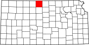 | |
| Unincorporated communities |
| |
| Ghost towns |
| |