Kalchreuth
Kalchreuth | |
|---|---|
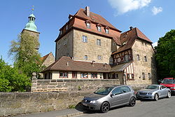 Kalchreuth Castle | |
 Coat of arms | |
Location of Kalchreuth within Erlangen-Höchstadt district  | |
 Kalchreuth  Kalchreuth | |
| Coordinates: 49°34′N 11°08′E / 49.567°N 11.133°E | |
| Country | Germany |
| State | Bavaria |
| Admin. region | Mittelfranken |
| District | Erlangen-Höchstadt |
| Government | |
| • Mayor (2020–26) | Herbert Saft[1] (FW) |
| Area | |
| • Total | 10.84 km2 (4.19 sq mi) |
| Elevation | 413 m (1,355 ft) |
| Population (2022-12-31)[2] | |
| • Total | 3,037 |
| • Density | 280/km2 (730/sq mi) |
| Time zone | UTC+01:00 (CET) |
| • Summer (DST) | UTC+02:00 (CEST) |
| Postal codes | 90562 |
| Dialling codes | 0911 |
| Vehicle registration | ERH |
| Website | www.kalchreuth.de |
Kalchreuth is a municipality in the district of Erlangen-Höchstadt, in Bavaria, Germany. It is 10 kilometers east of Erlangen and 15 kilometers north of Nuremberg and contains the villages of Kalchreuth, Käswasser and Röckenhof and also the hamlets of Stettenberg, Minderleinsmühle and Gabermühle.
Twin towns
 La Chapelle-des-Fougeretz (France), since 1993
References
- ↑ Liste der ersten Bürgermeister/Oberbürgermeister in kreisangehörigen Gemeinden, Bayerisches Landesamt für Statistik, 15 July 2021.
- ↑ Genesis Online-Datenbank des Bayerischen Landesamtes für Statistik Tabelle 12411-003r Fortschreibung des Bevölkerungsstandes: Gemeinden, Stichtag (Einwohnerzahlen auf Grundlage des Zensus 2011) .
Towns and municipalities in Erlangen-Höchstadt | ||
|---|---|---|
 | ||
| International | |
|---|---|
| National | |
| Geographic | |