Wiesbaden
| Wiesbaden | |
 | |
 | |
 Wiesbaden | |
| Coordinates | 50°5′0″N 8°15′0″E / 50.08333°N 8.25000°E |
| Administration | |
| Orílẹ̀-èdè | Germany |
|---|---|
| Ìpínlẹ̀ | Hesse |
| Admin. region | Darmstadt |
| District | Urban district |
| Town subdivisions | 26 boroughs |
| Lord Mayor | Sven Gerich (SPD) |
| Governing parties | CDU / FDP / Greens |
| Basic statistics | |
| Area | 203.9 km2 (78.7 sq mi) |
| Elevation | 115 m (377 ft) |
| Population | 275,422 (31 Oṣù Ọ̀pẹ̀ 2008)[1] |
| - Density | 1,351 /km2 (3,498 /sq mi) |
| Founded | 6 |
| Other information | |
| Time zone | CET/CEST (UTC+1/+2) |
| Licence plate | WI |
| Postal codes | 65001 - 65207, 55240 - 55252 |
| Area codes | 0611, 06122, 06127, 06134 |
| Website | wiesbaden.de |
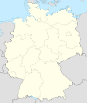
| Location of the town of Wiesbaden within Hesse | |
 | |
Wiesbaden je ilu ni orile-ede Jẹ́mánì, ni oluilu Ipinle Hesse.

|
Àyọkà yìí tàbí apá rẹ̀ únfẹ́ àtúnṣe sí. Ẹ le fẹ̀ jù báyìí lọ tàbí kí ẹ ṣàtúnṣe rẹ̀ lọ́nà tí yíò mu kúnrẹ́rẹ́. Ẹ ran Wikipedia lọ́wọ́ láti fẹ̀ẹ́ jù báyìí lọ. |
Itokasi
- ↑ Cite warning:
<ref>tag with namepopulationcannot be previewed because it is defined outside the current section or not defined at all.